


Parks That Might Have Been
A century-old vision for Oakland. And what its failure tells us about urban space today.

“The air at every season is soft and mild, the skies are blue, even often when fog hides the bay’s other shore, and the homes are separate houses, embowered in roses and wisteria and rising from gardens of lilies. What a place this appears, naturally and sociologically, for parks!”
— Charles Mulford Robinson
The air was indeed mild on the day I set out for a run, tracing a route from Oakland’s Chinatown around the sliver of shoreline encircling Lake Merritt. The sidewalk was narrow, in places pedestrians squeezed into mere feet between water and roadway,
To reach the woods in the hills meant following the canyons—narrow roadways slicing through residential neighborhoods where terraced homes are wedged together on steep hillsides. Eventually, I reached Dimond Canyon where the city’s edge softened into a narrow greenbelt that led to the unbroken wilderness of the regional parks beyond.
But for this slender path, a finger of unpaved canyon, Oakland is cut off from its own landscape. Most of the city is a place of pavement, a concrete morass baking beneath the sun when the fog abates to reveal a hardscape of curbs, streets, and low-slung housing. Its hillside parks, now reserved for the SUV Managerial Class, are walled off from the plebes by highways and defunded public transit.
Tarmac, so much tarmac, is wedged between most residents and wide open nature. Freeways bisect and bound the city, its bayside vistas extend in a horizon of hard angles.
It wasn’t supposed to be this way.
The Central Park That Never Was
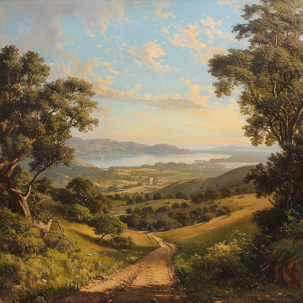
At the dawn of the 20th century, Oakland had the potential to become one of the world’s great park cities. An estuarine ecosystem ran up from the harbors: the city’s early lanes were lined with dense groves of coast live oaks, evoking the low-slung boulevards of New Orleans’s garden districts.
Further east was a wonderland of canyons—natural walled gardens, overhung by great trees, extended deep into the hills.
Unlike San Francisco, a city of windswept sand dunes and crowded wharves, or Los Angeles, a metropolis teetering between drought and flood, Oakland was a city that, if designed differently, could have been a model for urban greenery in America.
Oakland mayor Frank K. Mott wanted to build such a model.
In 1906 Mott enlisted urban planner Charles Mulford Robinson to examine the city “with a view to suggesting to its attractiveness and enhance its civic beauty.” Robinson, a key figure in the City Beautiful movement, proposed an ambitious expansion of open space: a grand park radiating outward from Lake Merritt in green corridors through canyons to the ridges.
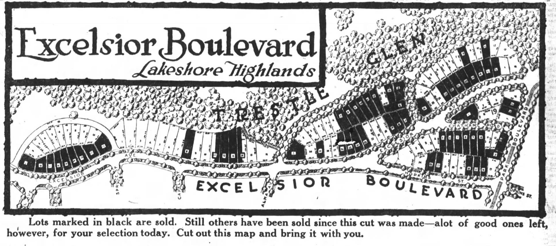
“Lake Merritt Park,” as Robinson called it, would have included not just the paltry strips around the lagoon that exist today, but also the bluffs above Lakeshore Avenue, with trails overlooking the city and beyond.1 The planned park included a garden at the head of the lake (currently an underpass of I-580) and spanned a tract of land called Indian Gulch, the modern-day Trestle Glen neighborhood, into Dimond Canyon.
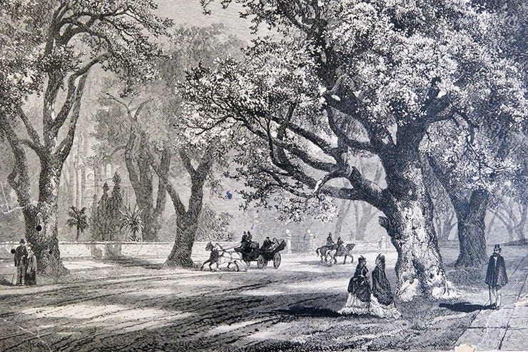
Robinson spent time ambling through Indian Gulch. He described the landscape as “one of the most picturesque and romantic walks and drives that can be found near any large city of my acquaintance in this or other countries.”2 Although privately held, the gulch was treated as open space. Overhung by large trees shading a stream, the land was used for picnics and hikes. The Salvation Army held annual campouts that brought thousands to enjoy the glen.
Robinson’s plan called for parkways to run up Grand and Moraga Avenues, connecting the lake to the existing Piedmont Park. But Trestle Glen would be the centerpiece, “a beautiful great gore” that connected the center city to hillside parks. Robinson dared Oakland to “screw up its park enthusiasm and its confidence in the future.” Even as he wrote, he knew the time available to build central park space was fleeting.3

Why We Lost the Park
Two forces conspired against Robinson’s vision: a speculative land economy and a city government unwilling to act.
California’s economy was, and remains, fundamentally extractive. From the first gold rush, to today’s AI bubble, the Golden State runs on capital ventures designed not for duration, but to squeeze quick profits from resources and inhabitants.
In the 1910s and 1920s, that speculative gaze re-envisioned land as real estate. Trolley lines were run out into hillsides, not for public transit, but to sell parcels to new homeowners. In 1917, a Key System trolley line was laid through Trestle Glen. Slowly, but steadily, the land leading out from Lake Merritt was subdivided and sold off.
The countervailing force that might have checked this development, municipal government, lacked the foresight, ideological gumption, and desire. Oakland’s longest-serving mayor, John L. Davies, resisted tax increases to pay for the essential Trestle Glen tract. Despite widespread public desire to turn at least part of the glen into park, the mayor defeated multiple attempts to lease the land.4
Newspaper articles from the time convey a sense of slow-moving horror. Oakland’s citizenry slowly realized that the common land of Trestle Glen, an obvious asset to the public, was headed toward dissolution.
Local hikers and representatives of the Sierra Club met at Redwood Peak, in what is now Redwood Regional Park, and passed a resolution requesting the city council “take immediate steps to acquire by purchase such portions of the Trestle Glen tract which the honorable council may deem necessary for preservation as a public park.”5
It wasn’t just conservationists. In January of 1920, Walter Cole, President of the Oakland Chamber of Commerce, told the city council “we are about to lose our road to Rome,” noting that loss of the glen would forever shatter the dream of a park running from downtown to the hillside wilderness.6
Faced with inaction, Trestle Glen’s landowners moved forward. The Olmsted Brothers, children of Central Park’s famed designer, were hired not to create a public green space, but to destroy one. The Olmsteds redesigned the glen as a private residential development.
The open space became another unremarkable suburban zone extracted from the land in a real-estate frenzy—part of the same explosion of suburban development in early 1920s California that parceled off St. Francis Wood and Westwood Park in San Francisco, as well as Bel Air and the Pacific Palisades in Los Angeles.
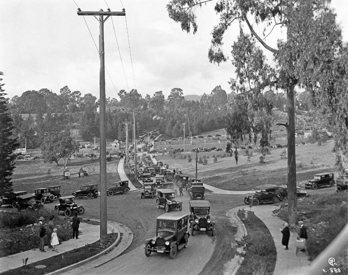
By the 1930s, what could have been Oakland’s Central Park was paved and parceled out, lost to the tides of suburban expansion. Today Trestle Glen is defined by single-family houses resting cheek-to-jowl in the usual mishmash of architectural styles favored by the California gentry.
A Second Chance?
No fate is final—only unfolding.
Today America is reconsidering its urban space. Most city land in Oakland is no longer available for park space. But there are discussions to remove I-980, a little-used freeway that cleaves through downtown Oakland. It’s a project, if handled with vision, that would improve the missteps of modernist development.

A century ago, Oakland failed to create its Central Park. But could it now rethink public space in a way that reconnects people with the land? The challenge is exceptional. Now, much like a century ago, the city’s management is lacking. But the first step is to imagine that a different world is possible.
Imagine a network of parkways, softened with paths linking downtown to the hills. Imagine streets designed not just for cars, but for people—for neighbors, children, walkers, and cyclists.
Imagine the return of the oak trees to Oakland, no longer relegated to the city’s flag, but growing again in low-slung groves that shade the boulevards. Imagine walkers strolling lanes of shops and restaurants as cyclists pedal to and from work.
I can almost see it: children swinging in the low oak branches as golden twilight bathes the trees and the city breathes in the joy of its own movement while the sun sets over the bayside.
More from Footnotes


That’s all for this week. Thanks for reading.
Charles Mulford Robinson, A Plan for Civic Improvement for the City of Oakland, California (Oakland Enquirer Publishing Co, 1906), 5. Robinson anticipated 21st-century street-narrowing trends, recommending the boulevard along the eastern side of Lake Merritt be narrowed: “Its needlessly great width is unpleasant, and incidentally adds large expense for maintenance to the glare and dust and loneliness of the road.” He suggested a bridle path, separated from the road by trees and shrubs.
Robinson, Plan for Civic Improvement, 6.
We now tend to think of parks in terms of conservation—idyllic natural space where the main interventions on the landscape are to provide unintrusive access via trails and trailheads. But at the turn of the century, the notion of parks was inherited from the European pleasure gardens that often surrounded palaces. Such spaces were landscaped and shaped to accord with aesthetic and entertainment desires. Progressive reformers like Robinson recommended “a variety of attractions to suit the varied tastes of the community’s members.” The park should provide opportunity for “driving, for walking, and if possible for boating; there should be places for picnics, for meditation and for games; the landscape work should include, if feasible, both the natural and the artificial.” The cascade in Cleveland Heights, an artificial waterfall type fountain is a good example of the sorts of entertainment. Robinson, Plan for Civic Improvement, 4, 6.
“Davie Opposed to Leasing Park” Oakland Enquirer, January 24, 1917, 12.
“Urge Preservation of Trestle Glen” Oakland Enquirer, April 25, 1921, 3.
“Trestle Glen Is Urged for Oakland Park,” Oakland Tribune, January 6, 1920.
…what it might have been!!…doubtful we ever see something as spectacular as that 980 idea…oakland can barely fix its potholes lol…but what it could be!!…
Since I used to live there (on Mesa Ave near Moraga Ave, in a house built in 1909 during the era you describe), and ran almost all the streets shaded green in the map, I find this fascinating. However, you don’t mention the great quake of 1906. My understanding is the residential areas around Piedmont, Trestle Glen & Lakeshore sprung up soon following the quake because SF was in ruins so residents migrated to Oakland. I imagine that catastrophe played a role in changing or overshadowing the park proposal.